“The map? I will first make it.” ― Patrick White, Voss
(goodreads)
Technical Report Fold-out Map Series
Bontrager (Toivola), Andra. Complete Map Series [MAP]. In: Brock, B.L., E.C. Atkinson, C. Groves, A. Toivola, T. Olenicki and L. Craighead. High-quality wildlife connectivity areas in the Madison Valley Watershed. Wildlife Conservation Society, Greater Yellowstone Program, Bozeman, MT. 2005.
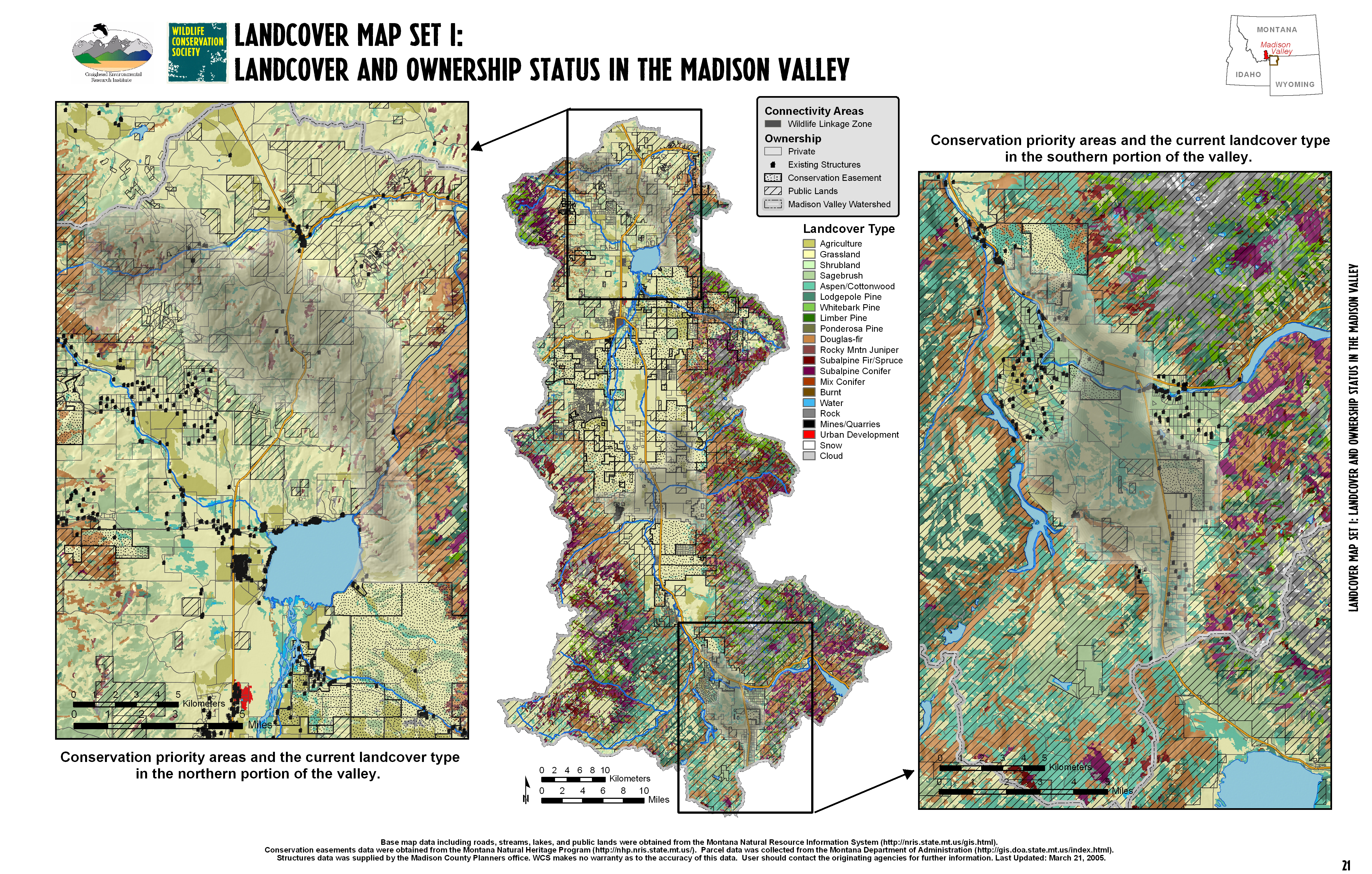
Land Cover Map Set I: Land Cover and Ownership Status in the Madison Valley
Conservation priority areas shown with landcover type in the northern and southern portions of the valley.
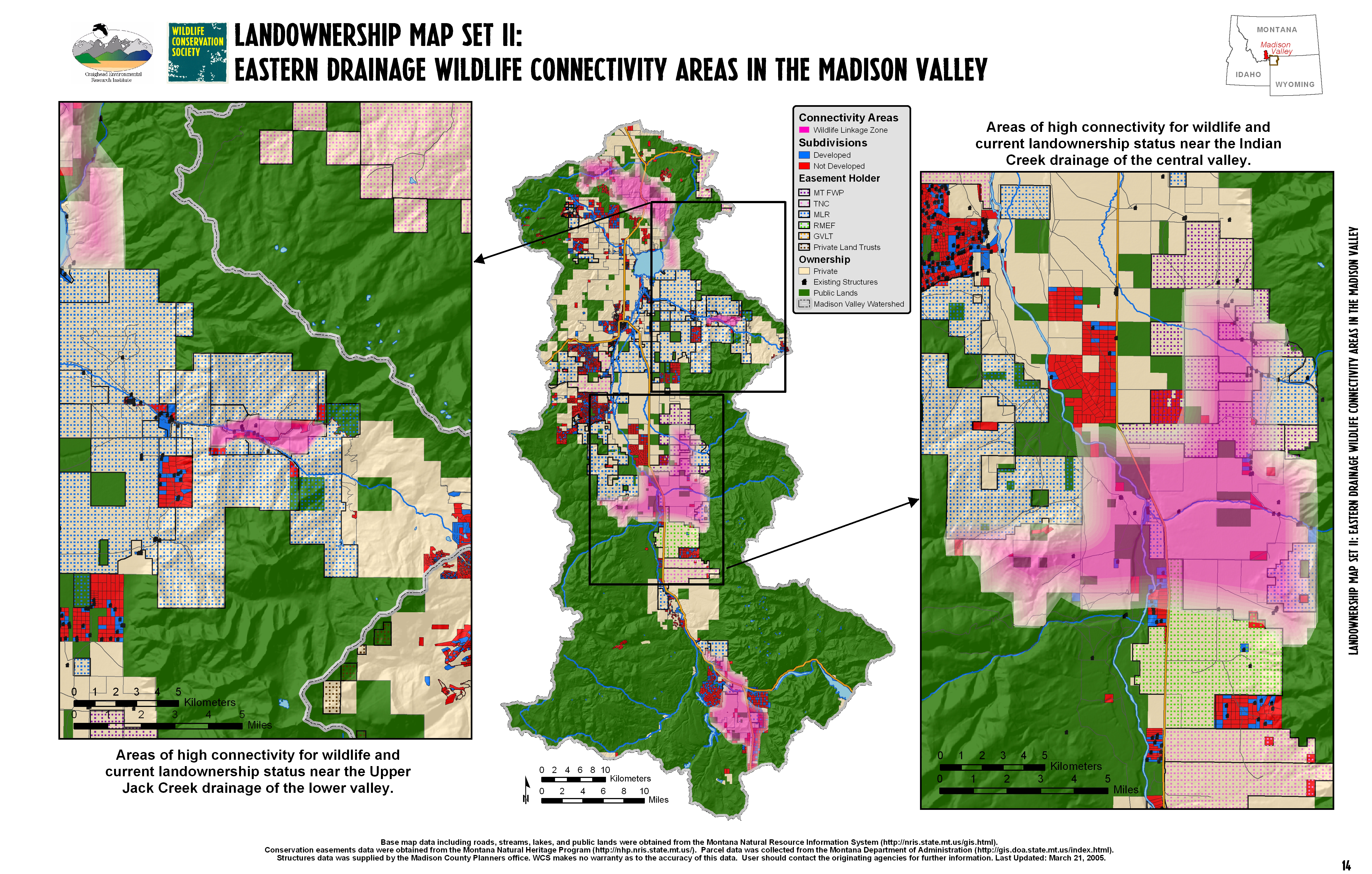
Land Ownership Map Set II: Eastern Drainage Wildlife Connectivity Areas in the Madison Valley
Areas of high connectivity for wildlife with land ownership status near the Upper Jack Creek drainage of the lower valley and the Indian Creek drainage of the central valley.
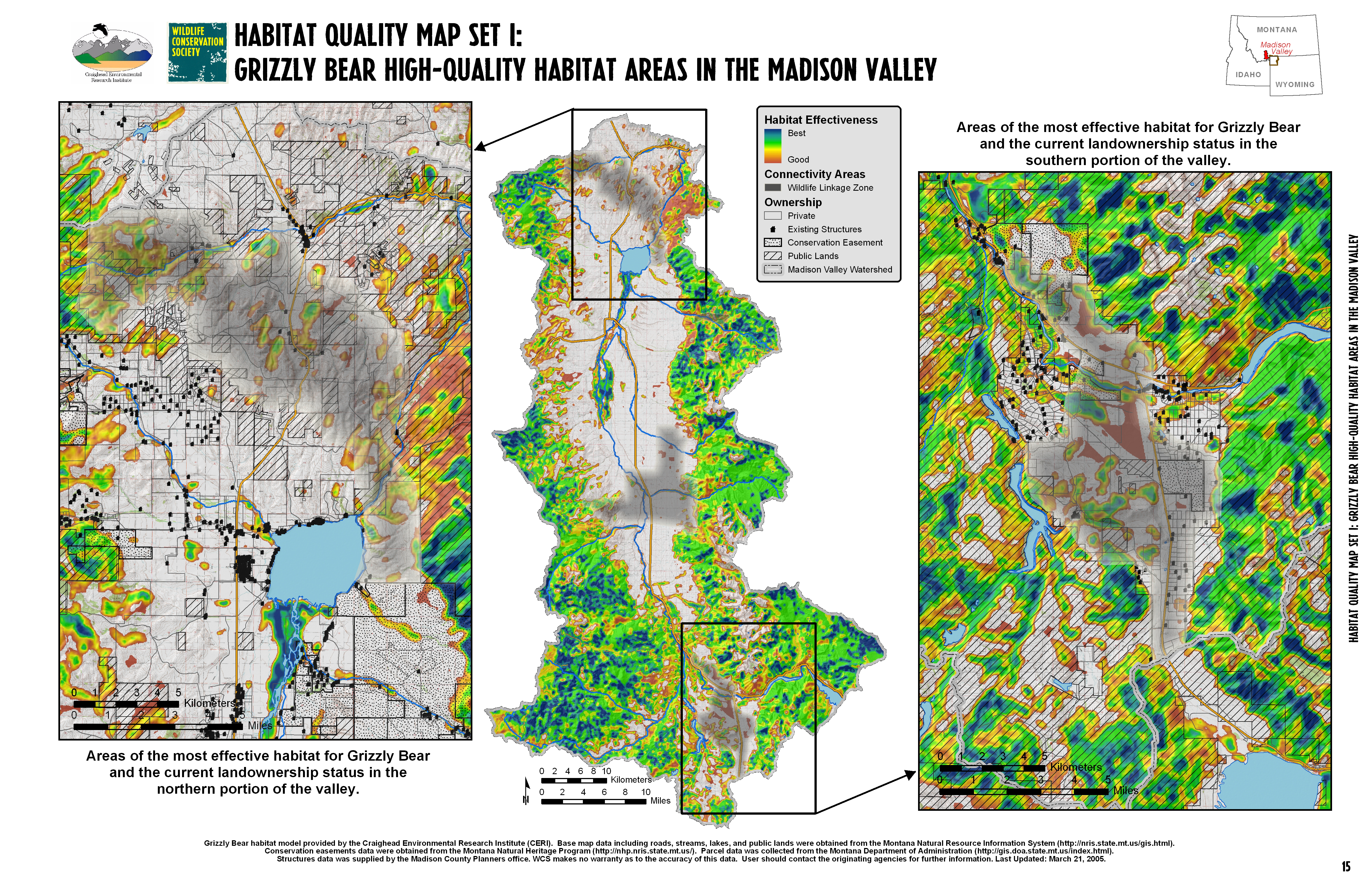
Land Connectivity Map Set I: Grizzly Bear High-Quality Habitat Areas in the Madison Valley
Areas of the most effective habitat for Grizzly Bear and land ownership status in the northern and southern portions of the valley.
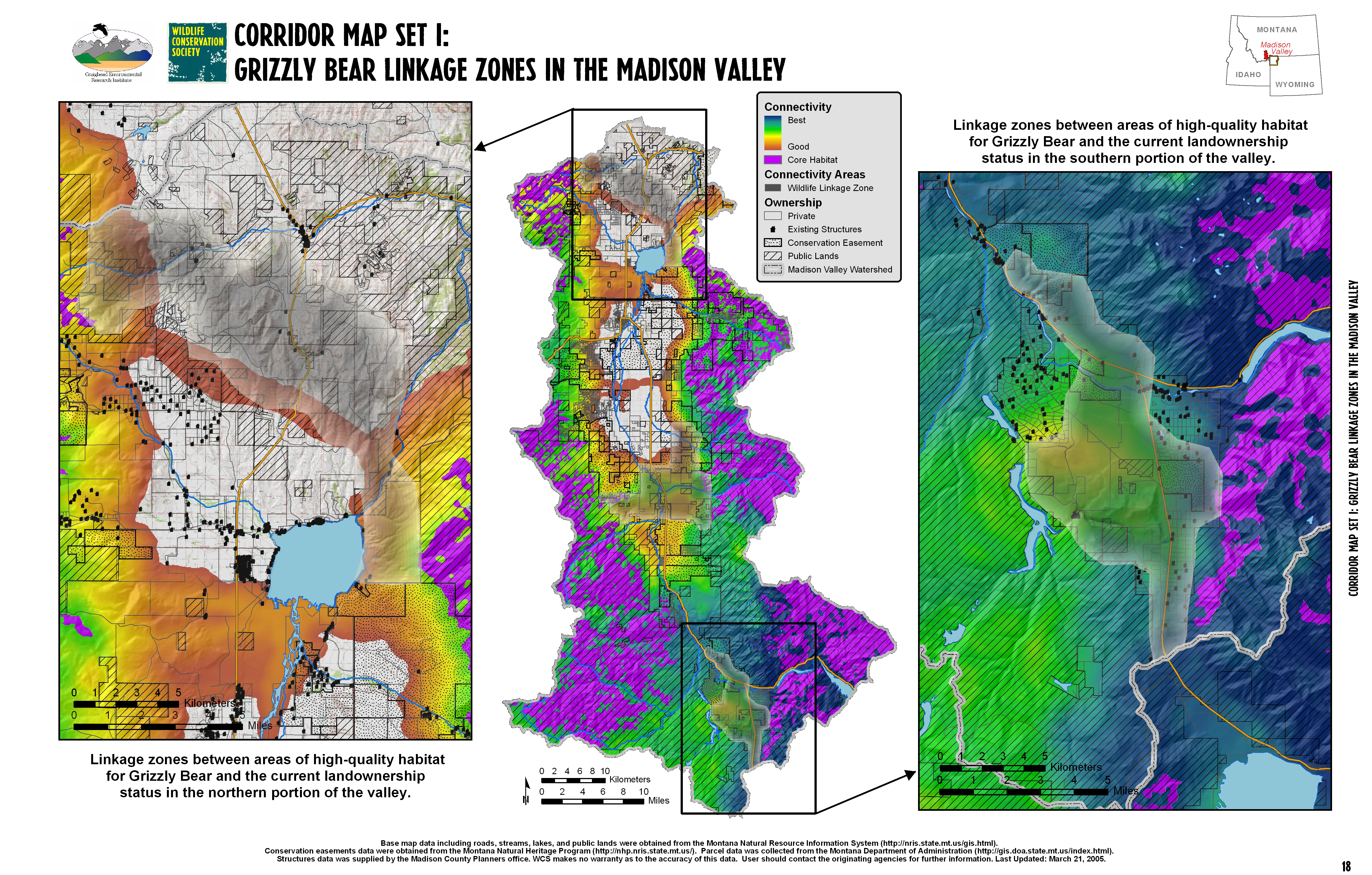
Corridor Map Set I: Grizzly Bear Linkage Zones in the Madison Valley
Linkage zones between areas of high-quality habitat for Grizzly Bear shown with land ownership status in the northern and southern portions of the valley.
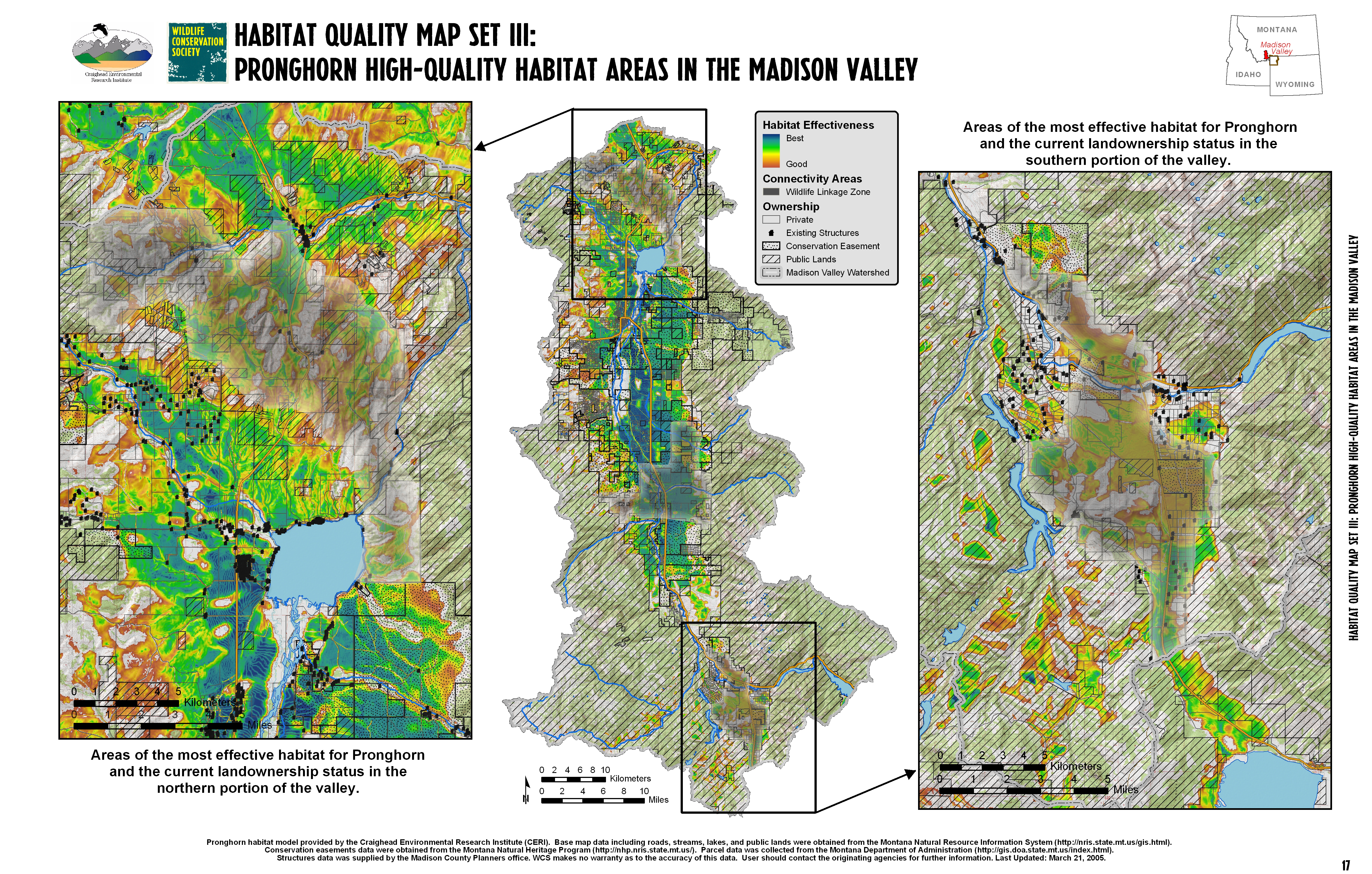
Habitat Quality Map Set III: Pronghorn High-Quality Habitat Areas in the Madison Valley
Areas of the most effective habitat for Pronghorn shown with land ownership status in the nosrthern and southern portions of the valley.
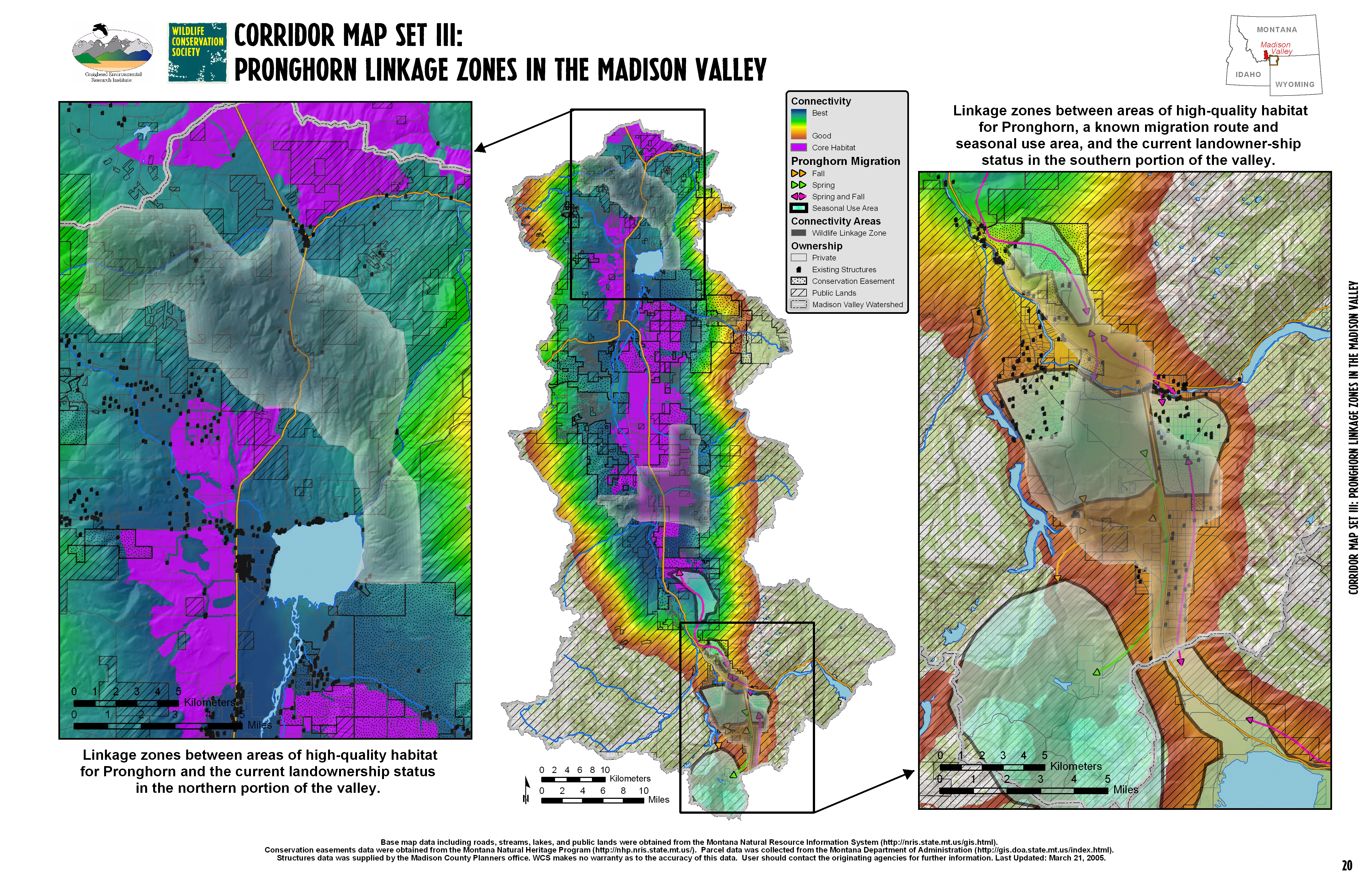
Corridor Map Set III: Pronghorn Linkage Zones in the Madison Valley
Linkage zones between areas of high-quality habitat for Pronghorn shown with land ownership status in the northern and southern portions of the valley, including a known migration route and seasonal use area.
Grayscale Book Map Series
Bontrager (Toivola), Andra. Complete Map Series [MAP]. In: Berger, Joel. The Better to Eat You With: Fear in the Animal World. Chicago: University of Chicago Press, 2008. Pgs. Inside Cover, 7, 43, 85, 95, 115, 129, 151, 161, 175, 195, 219, 237.
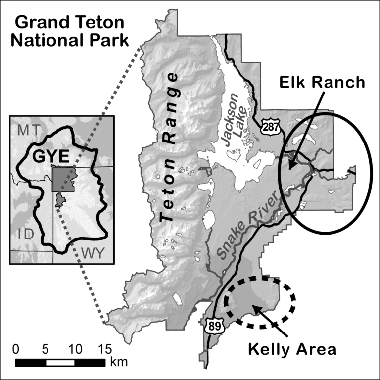
Study Area Map
This chapter map highlights Grand Teton National Park within the Greater Yellowstone Ecosystem
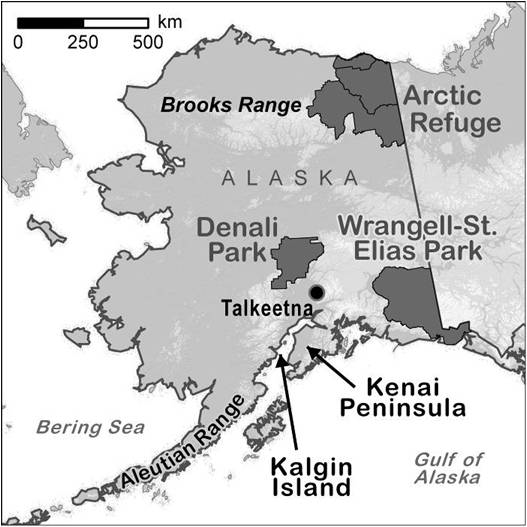
Chapter Map of Alaska
Chapter map showing National and State Parks with landscape features including the Kenai Peninsula, Kalgin Island, and the Aleutian and Brooks Ranges.
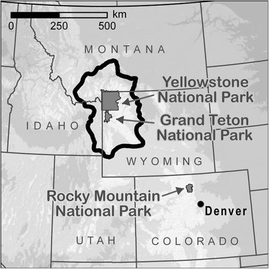
5 State Map showing Greater Yellowstone Ecosystem and National Parks
Chapter map showing the National Parks in proximity to the Greater Yellowstone Ecosystem
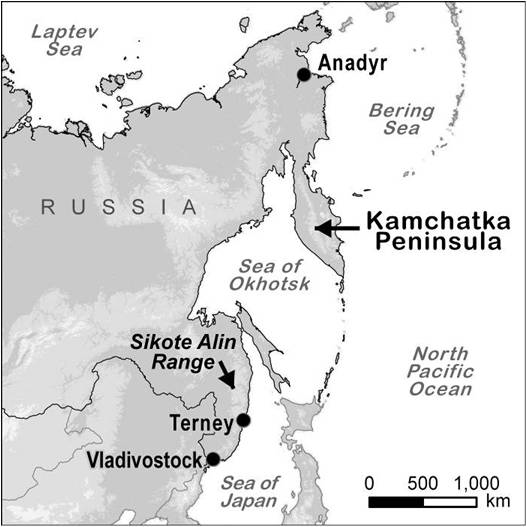
Northern Russia Chapter Map
Map illustrating the proximity of the Bering Sea and the Sea of Okhotsk in relation to the Kamchatka Peninsula and the Sikote Alin Range.
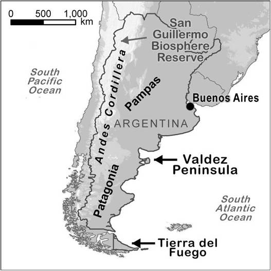
Argentina Chapter Map
Chapter map illustrating the areas of Patagonia and the Pampas near the Valdez Peninsula and Tierra del Fuego.
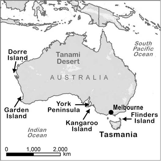
Chapter Map of Australia and Tasmania
Reference map showing the Australian continent and the prominent natural features including Dorre Island, Garden Island, York Peninsula, Flinders Island and Kangaroo Island.
Select Presentation Maps
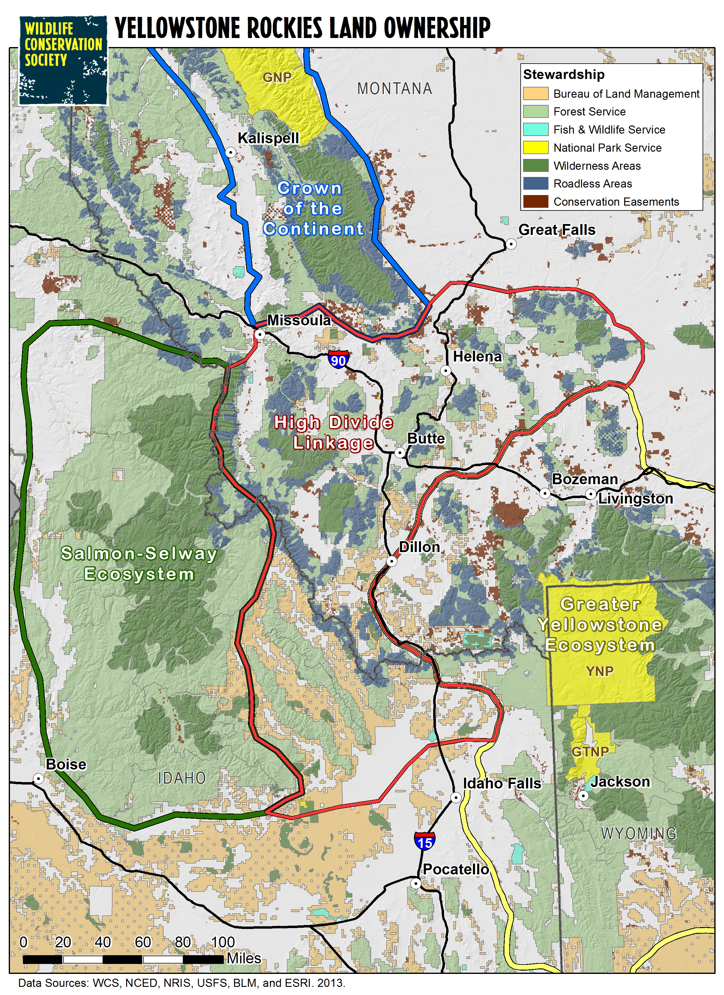
Yellowstone Rockies Land Ownership
2005
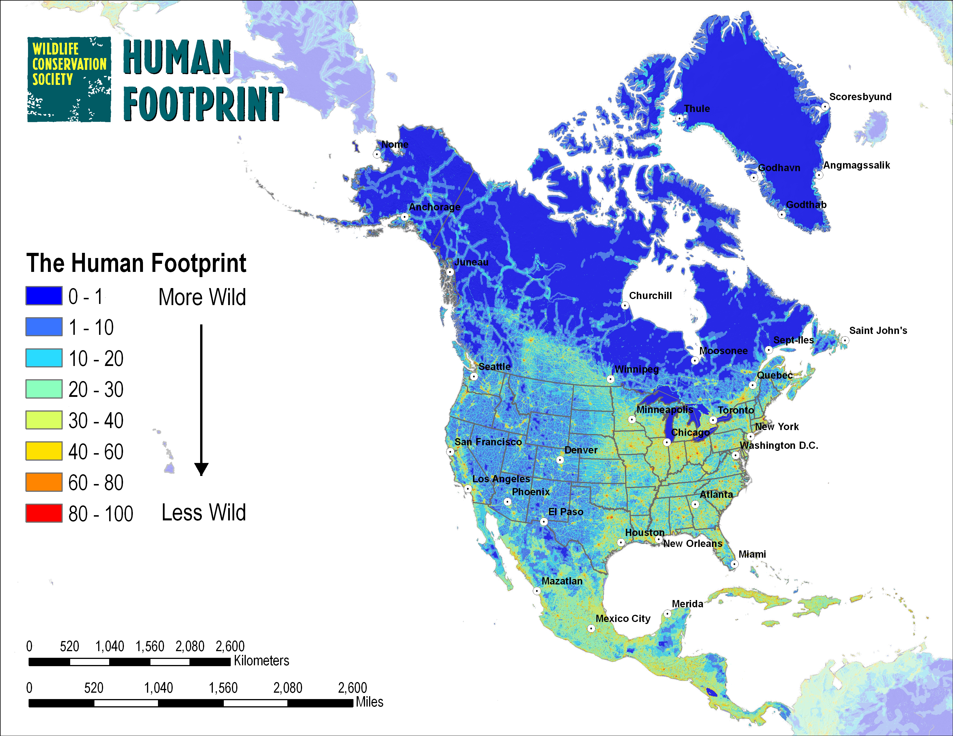
Map of Human Footprint in North America
2007
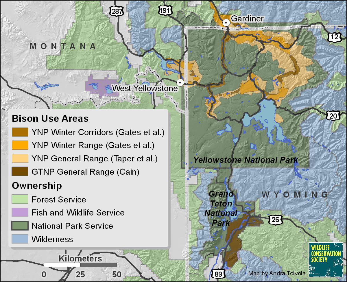
Bison Use Areas in Yellowstone National Park
2008
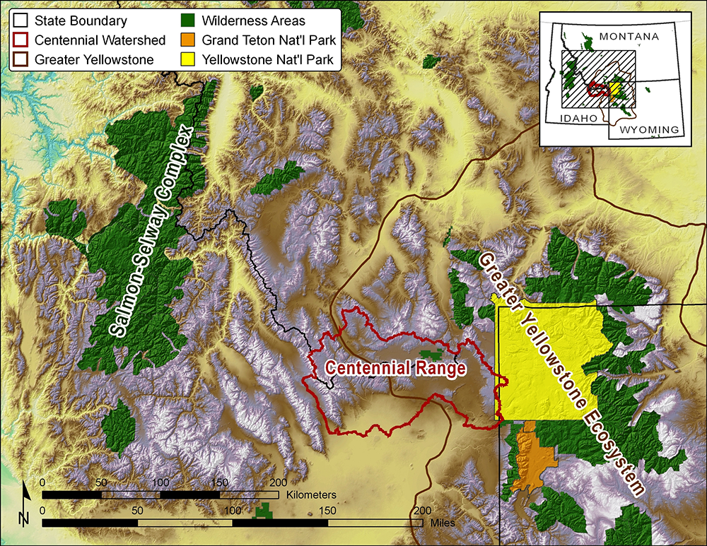
Greater Yellowstone Ecosystem Mountain Ranges
2009
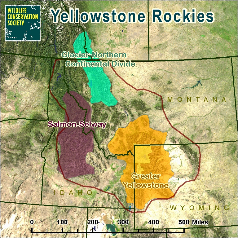
Yellowstone Rockies Mountain Ranges
2010
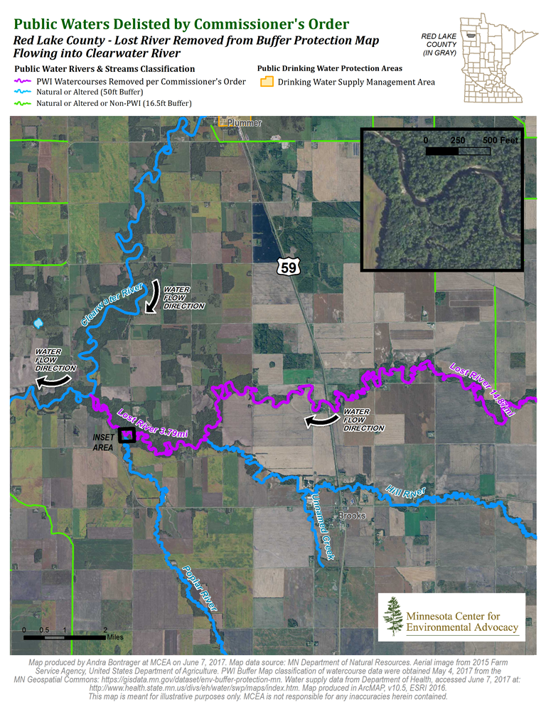
Public Waters Delisted by Commissioner' Order
2017
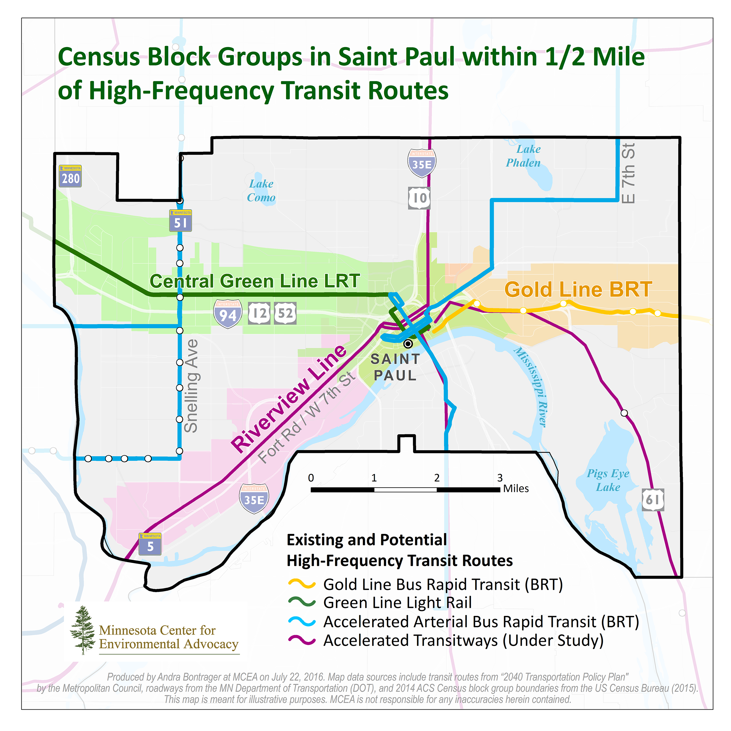
Census Block Groups Near Transit Routes
2016
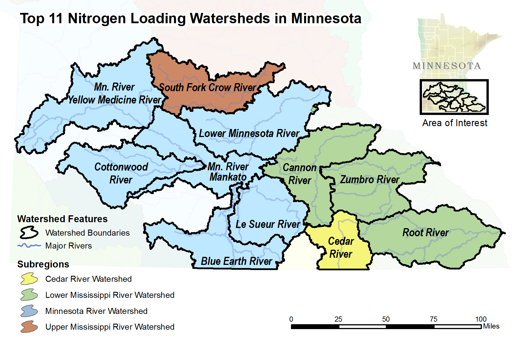
Top 11 Nitrogen Loading Watersheds in Minnesota
2017
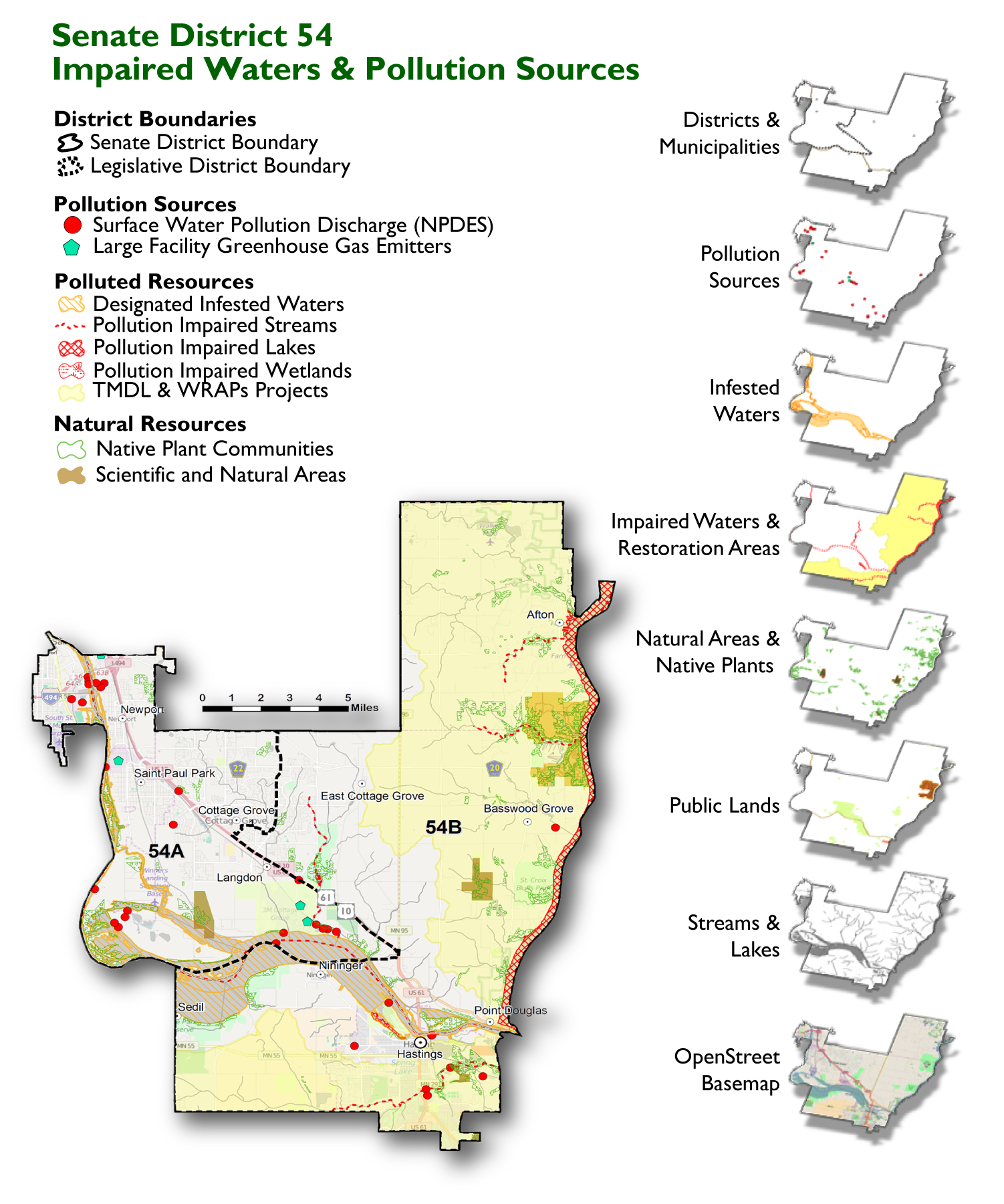
Senate District 54 Impaired Waters Newsletter Map
2017