“A map is the greatest of all epic poems. Its lines and colors show the realization of great dreams.” — Gilbert H. Grosvenor, Editor of National Geographic
(gis lounge)
Informational Posters
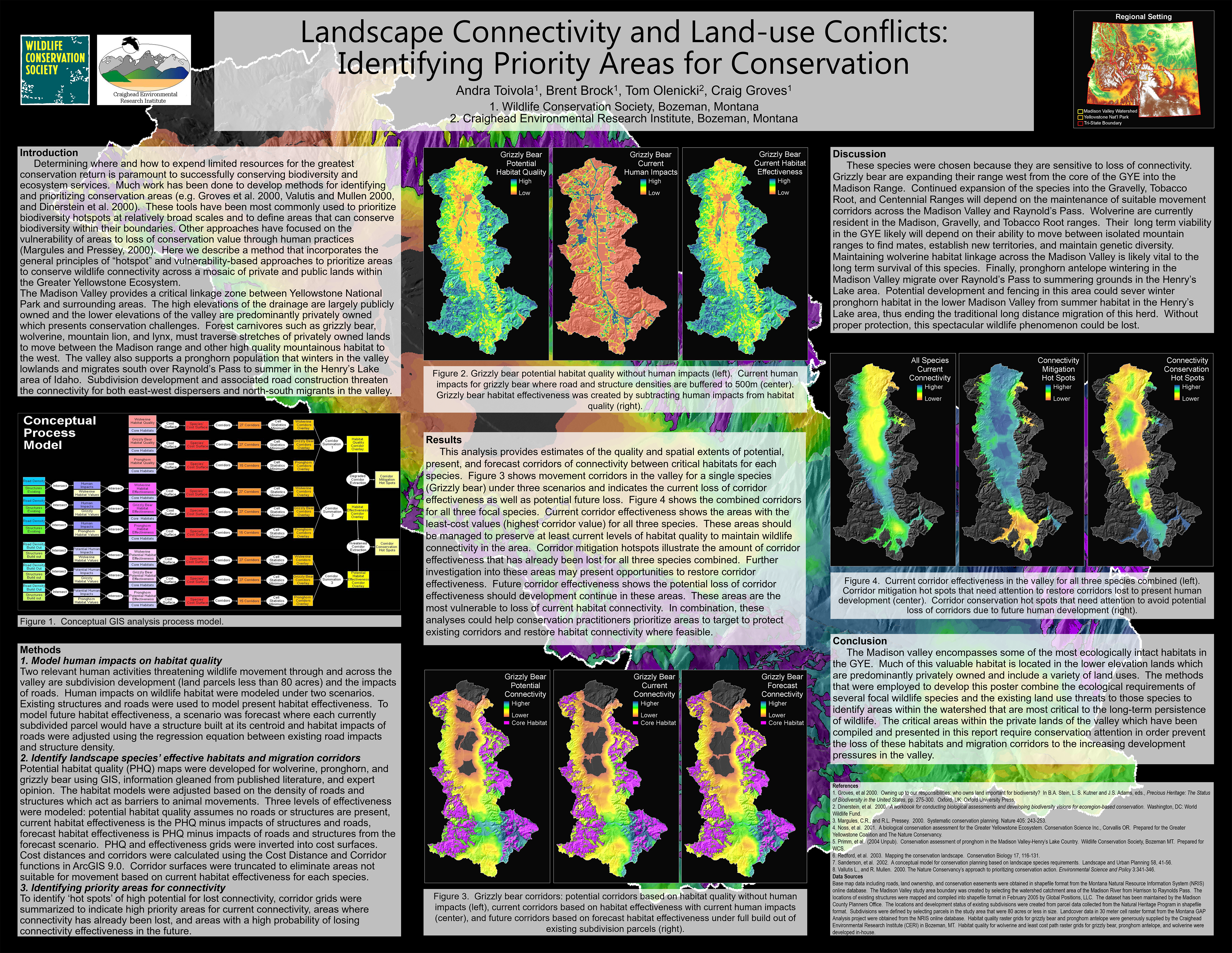
Landscape Connectivity and Land Use Conflict: Identifying Priority Areas for Conservation
2005
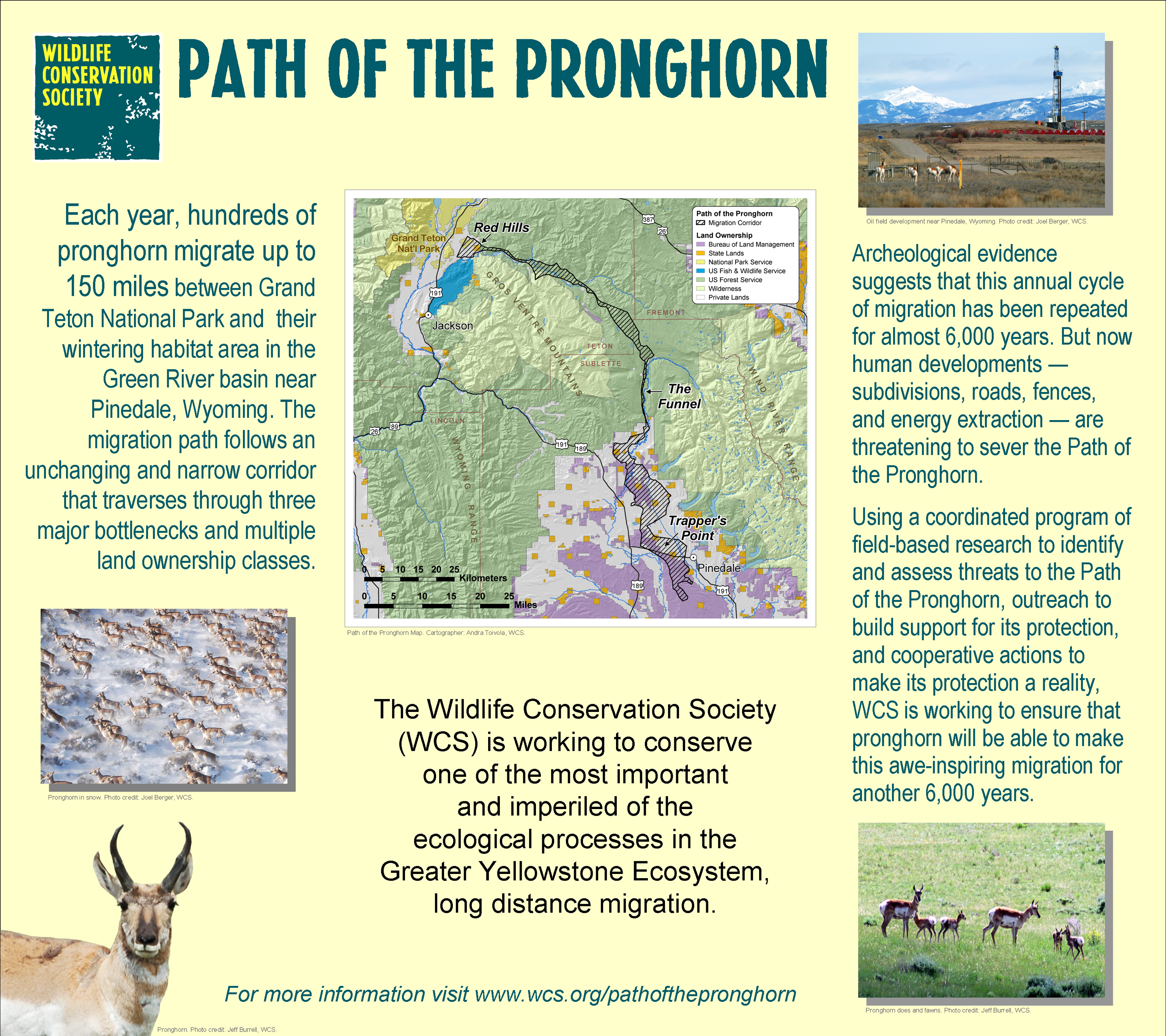
Path of the Pronghorn Migration Corridor
2008
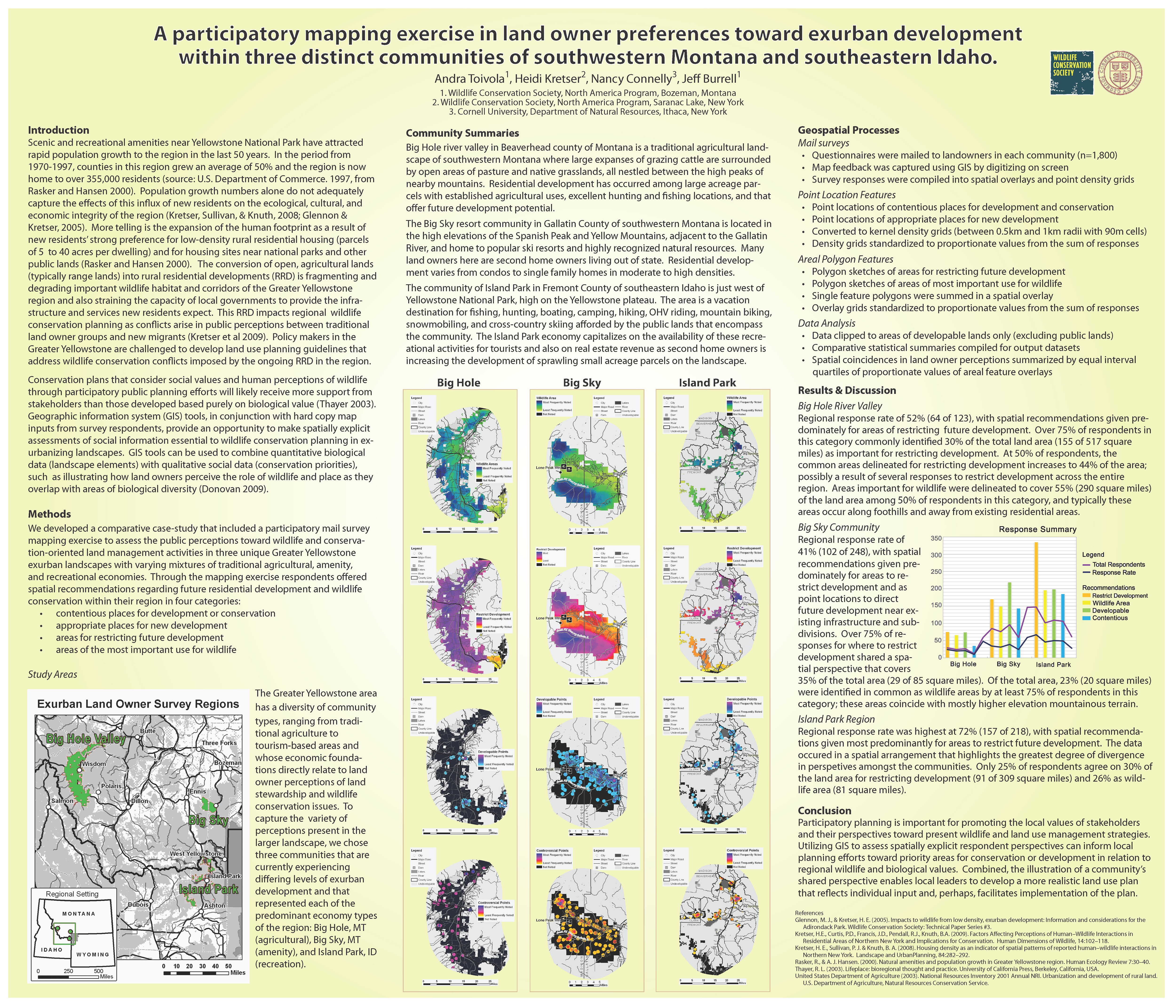
Participatory Mapping Excercise in Land Owner Preferences Toward Exurban Development
2010
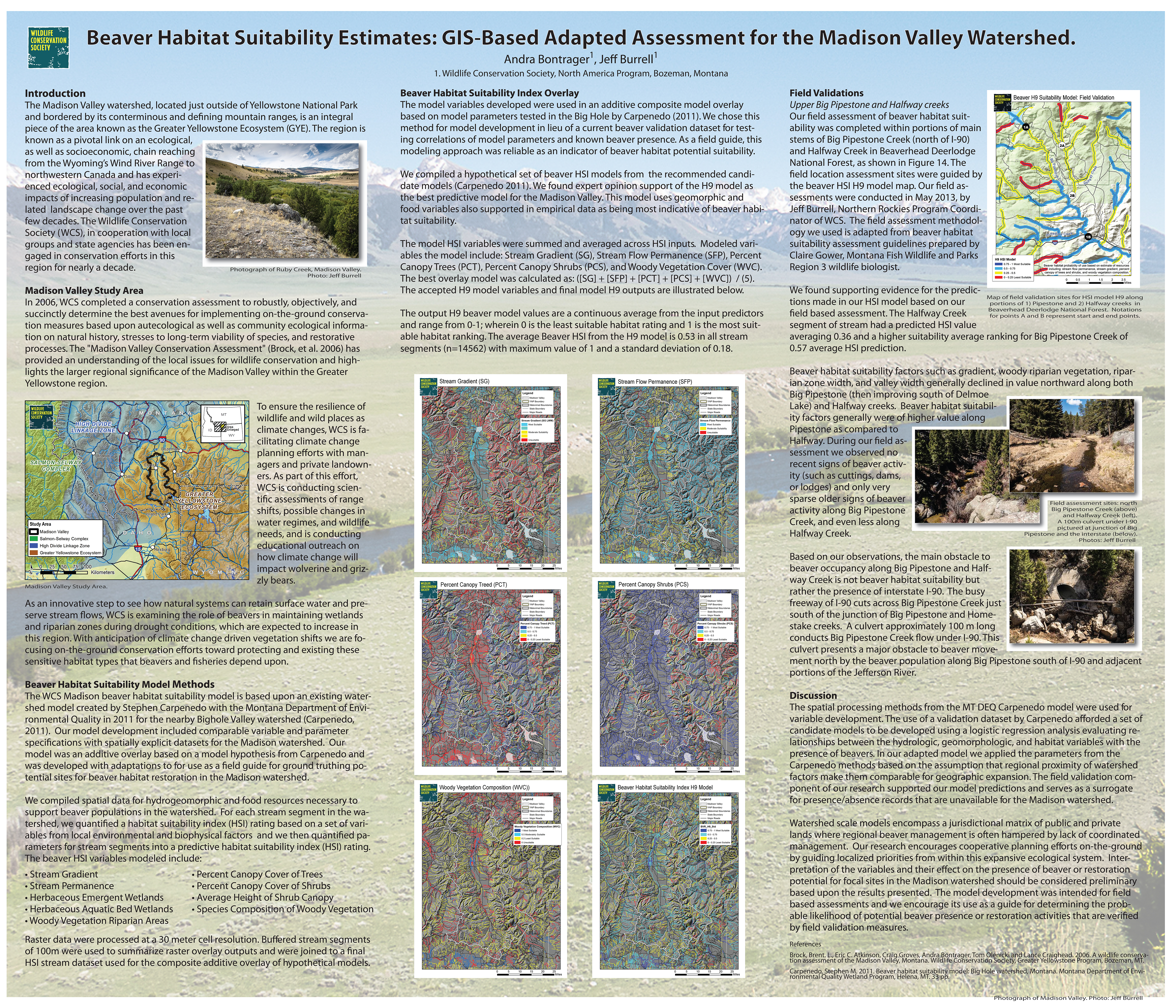
Beaver Habitat Suitability Estimates: GIS-Based Adapted Assessment for the Madison Valley Watershed
2014
Inver Grove Heights Community Solar Gardens: Site Potential GIS-based Assessment
2015
Public Geospatial Data Archive Survey
2018
Public Geospatial Data Archive Stakeholder Pilot
2021
Water Level Monitoring for Wildlife Habitat Mangement
2024
Infographics
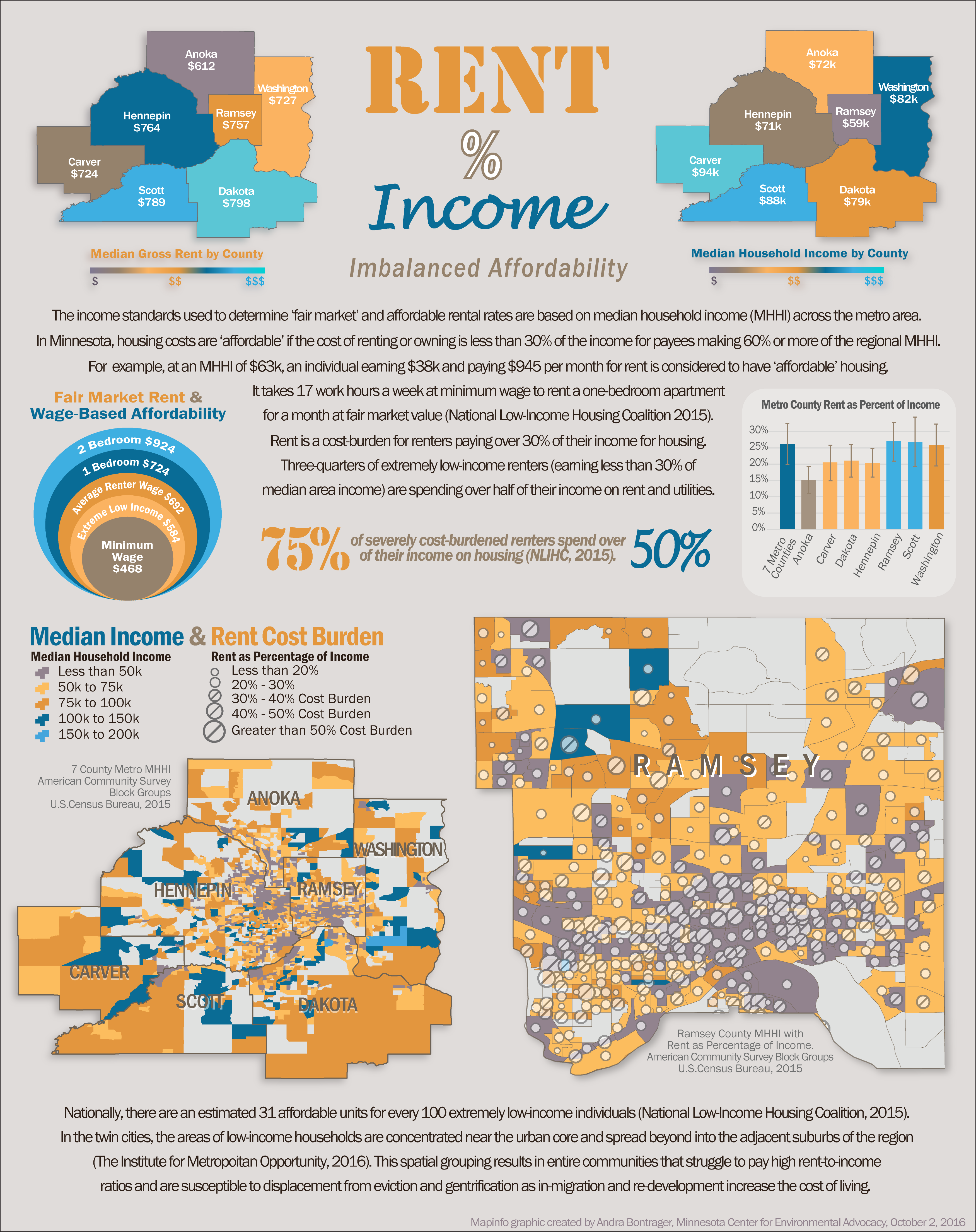
The Cost of Rent Burden
2016
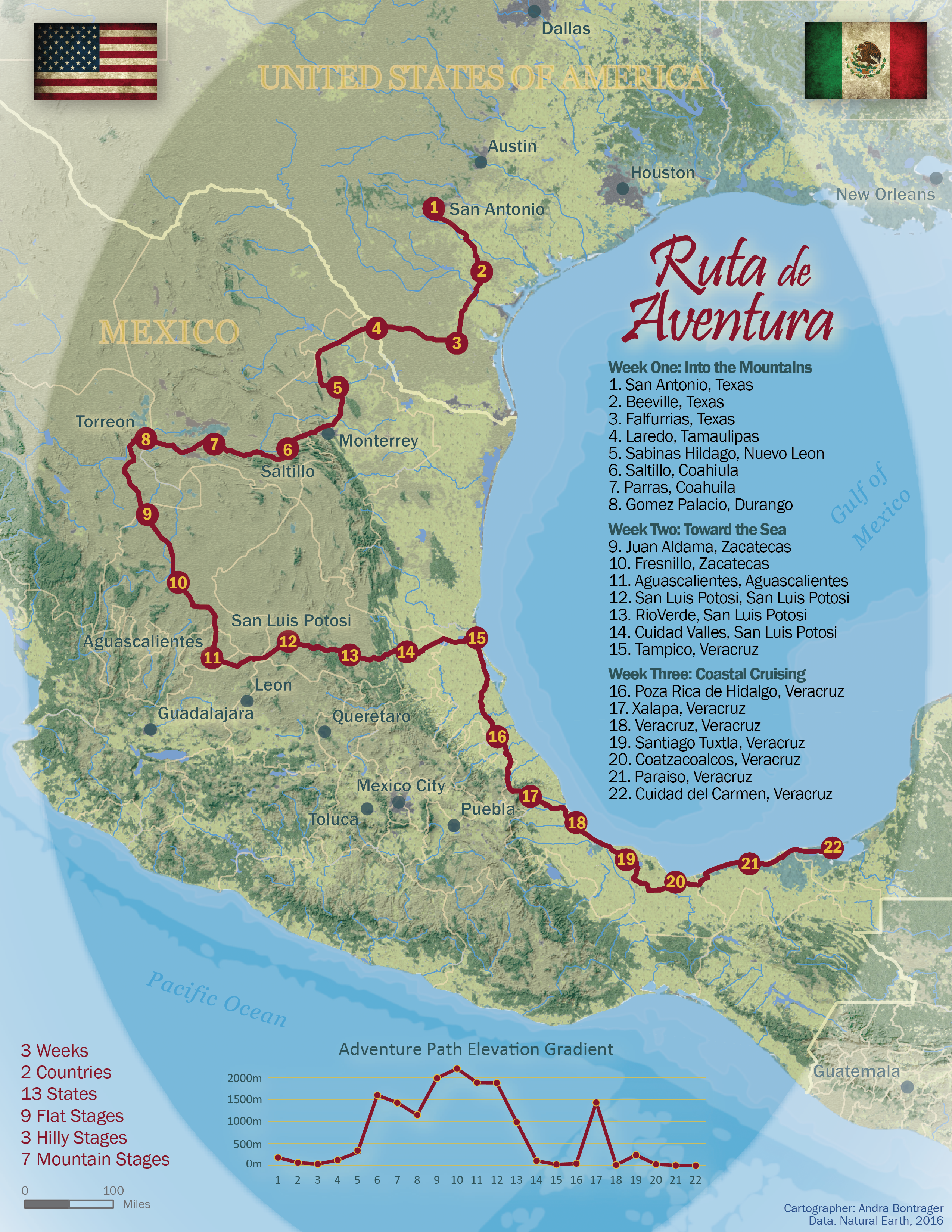
Fictional Bike Race Route: Ruta de Aventura
2016
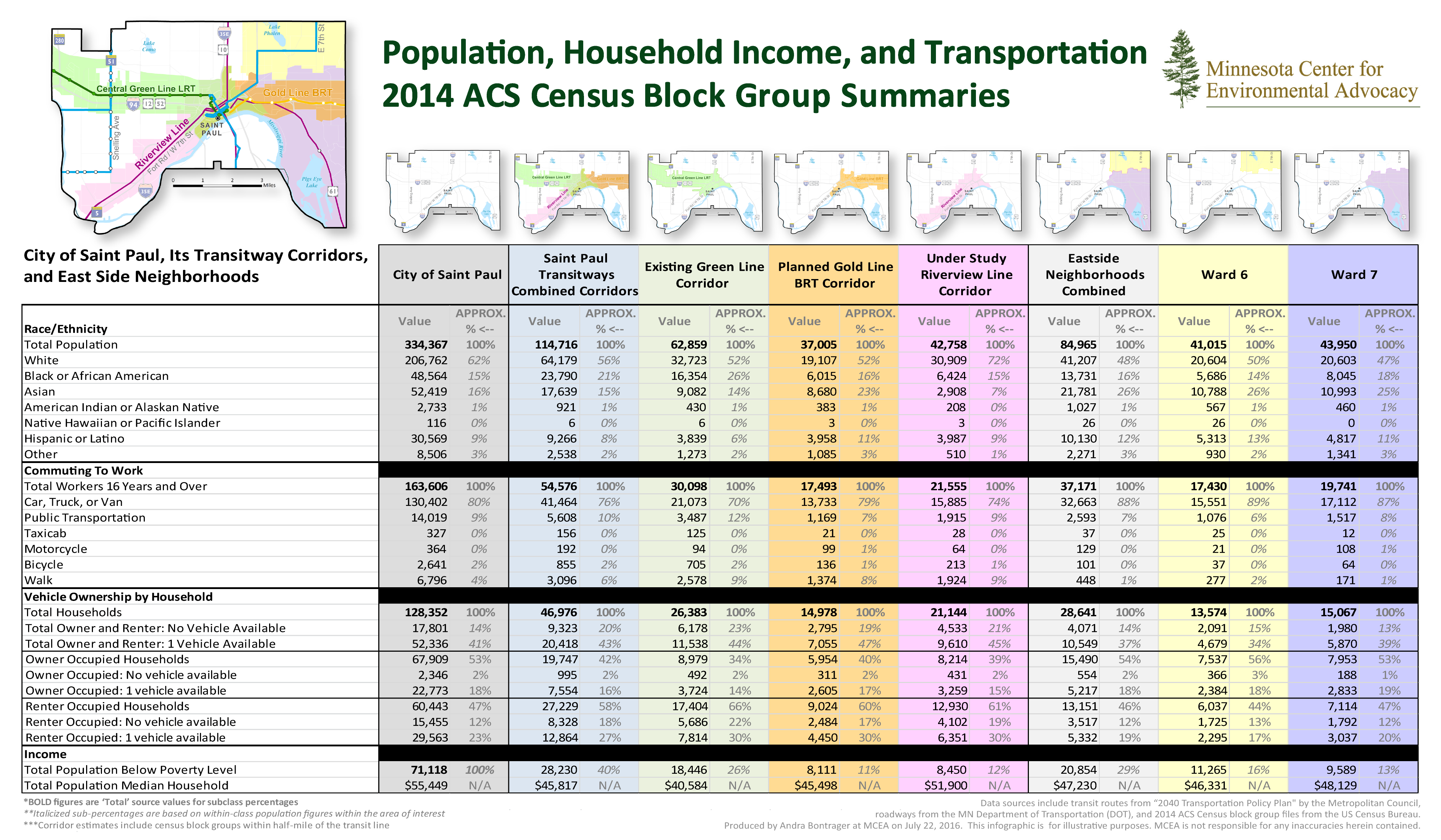
Population, Household Income, and Transportation: 2014 ACS Census Block Group Summaries
2016
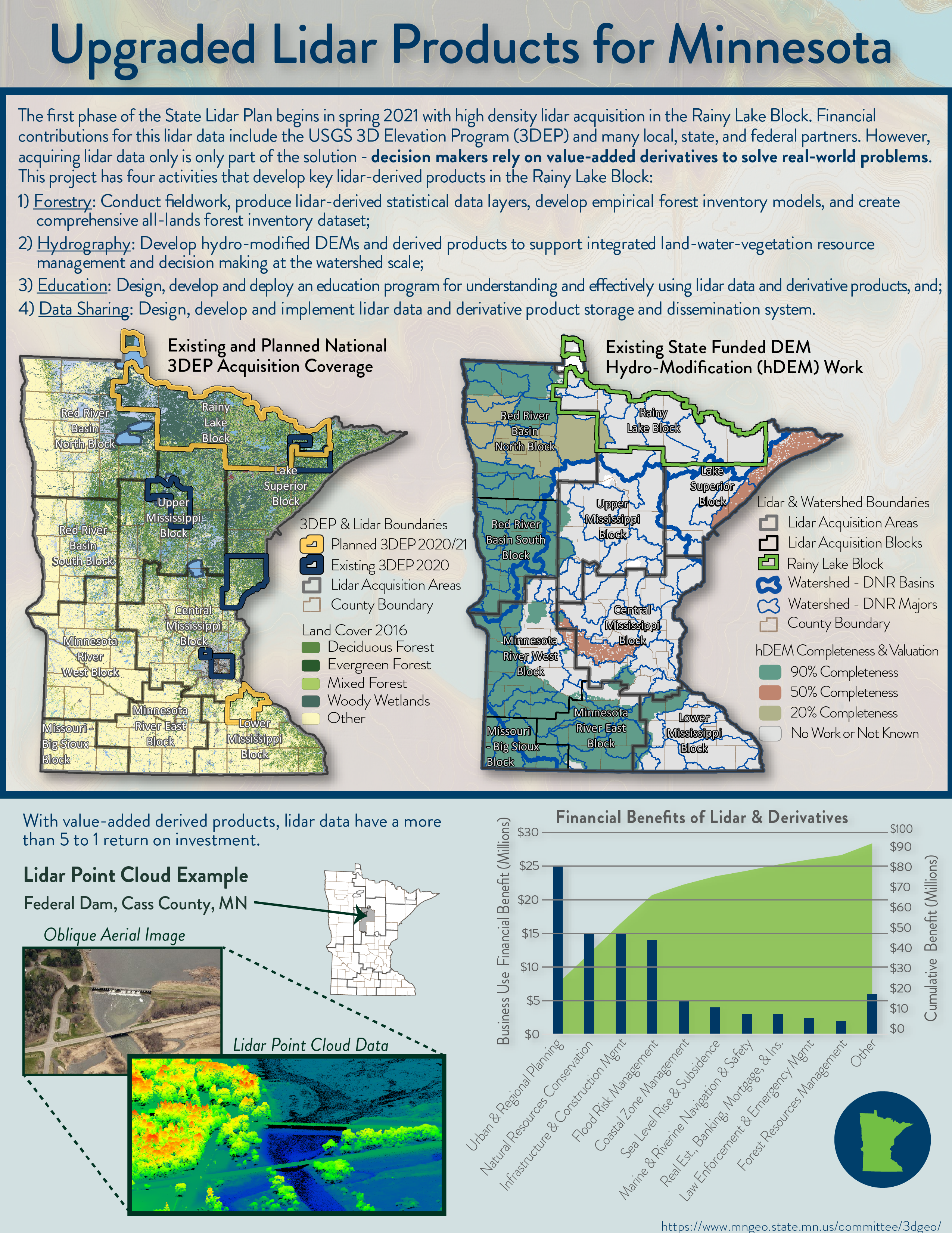
Upgraded Lidar Products for Minnesota
2020
Reference Wall Maps
Elevation and Hydrography
2015
Landcover Classification
2015
Fire Department Emergency Response
2015
Land Use
2015
Patrol Roads and Streets Map
2015
Parks and Rec Wall Map
2015
Minneapolis & St Paul: Metro Employment Clusters
2016
Minneapolis & St Paul: Metro Location Affordability Indexes
2016
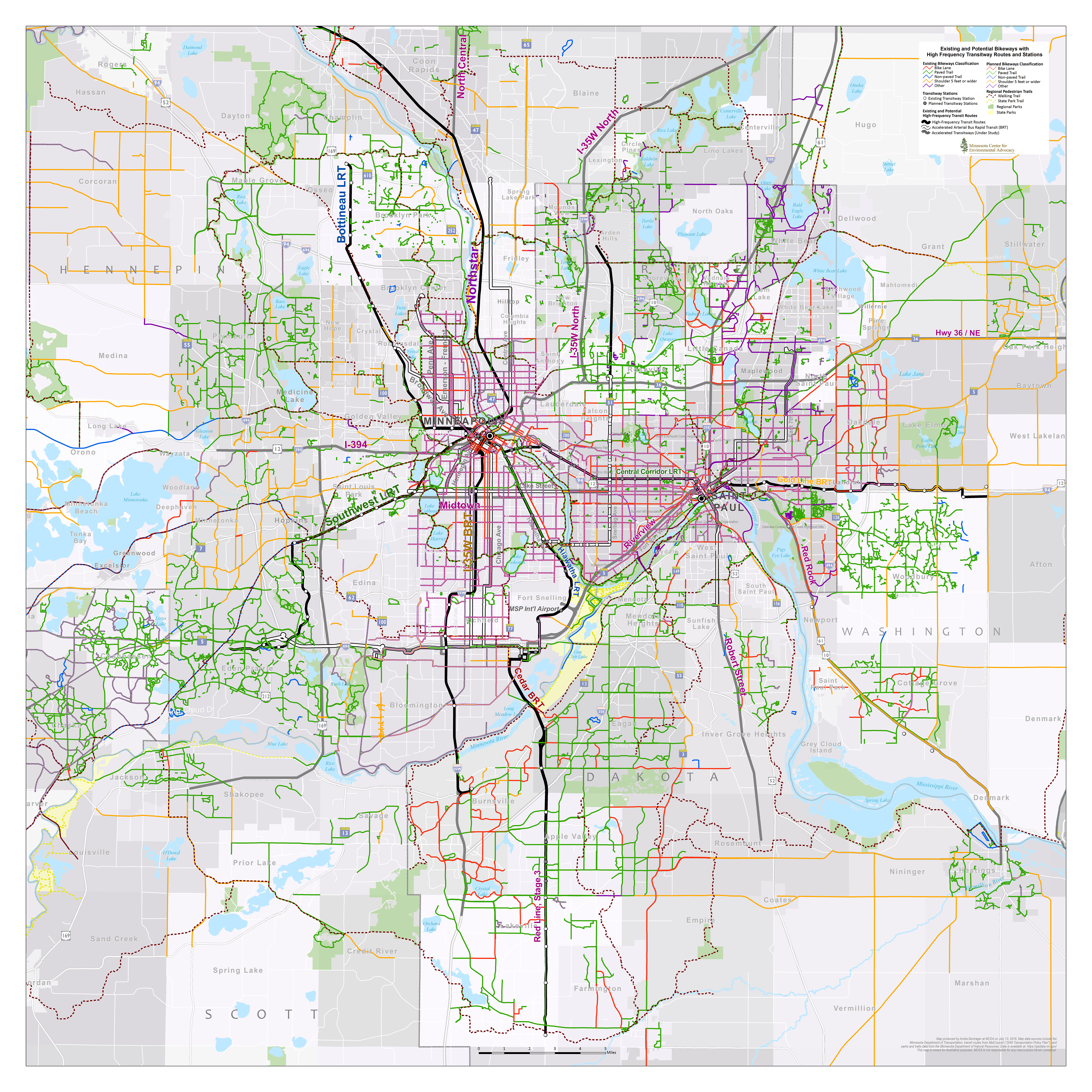
Minneapolis & St Paul: Metro Bikeways and Transitways
2016